
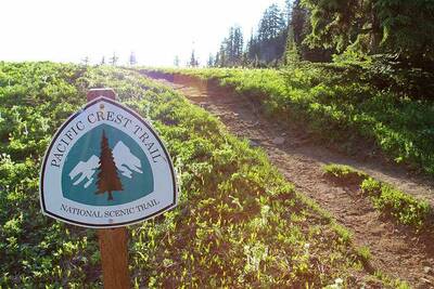
Backpackers.com — The Pacific Crest Trail is a 2,663 mile trail that stretches from the Washington/Canadian border to the north, and the U.S./Mexico border to the south. Commonly referred to as the PCT, the trail is legendary in its scope, and passes through 7 national parks and 25 national forests in the U.S.
The Pacific Crest Trail Association published a guide to thru-hiking the southbound trail, and we wanted to highlight it!
Thru-Hiking the PCT
While the trail is often done in chunks — that range from 10 mile pieces over a lifetime, to 250 mile stints in a gnarly month — the most intense way to approach the PCT is by thru-hiking it. This means either starting at the south end, near Campo, CA, just north of the Mexico border — or at the northern border, on the edge of Manning Park in British Columbia.
Most thru-hikers choose the northbound route (NOBO), usually beginning in April and ending in September. The reasons for this are numerous, but the most common one is getting over the mountainous hurdle that is stormy weather and deadly conditions in the Sierra Nevada in California. When you start at the edge of Mexico, you pass through this area during a warmer time of year. But the southbound route (SOBO) means you'll traverse these lands close to snowfall, so you have to be even more careful.
But there are benefits to the SOBO route, which the Pacific Crest Trail Association (PCTA) has laid out in a handy and helpful guide. For those considering a thru-hike of the PCT, and aren't sure which route to take, make sure to read the PCTA's extensive amount of information on the subject. We like this guide because of its frankness — it's not the one-stop-shop for your hike, but rather an excellent and comprehensive primer for those getting started. If you're considering a SOBO thru-hike, definitely refer to this guide. It's a great one.
Pacific Crest Trail Association SOBO Guide
Some helpful quotes from the article:
On why the SOBO route is beneficial,
“There are many great reasons to go in this direction. The opportunity for solitude and reflection are greater, towns won’t be busy with hikers, you will experience most of California without mosquitoes and your walk through the desert will be during late fall when days are cooler.”
On the importance of weather, and timing,
“The question of when it will snow in the Sierra defines a southbound thru-hike. No one knows. The first snow storm could drop a few inches, or it could drop feet.”
On the timing difference between the NOBO and SOBO routes,
“Conventional wisdom, in a normal year, is that northbounders should leave Kennedy Meadows around June 15th and reach Canada by September 30th. That’s 3.5 months. Conventional wisdom for southbounders is that they should leave Canada around early July and reach Kennedy Meadows South in early to mid-October. That’s about three months, possibly a little more.”
And on why you should probably be a seriously fit hiker if you plan the SOBO route,
“Southbound thru-hikers need to be fit right from the start of their hike since they will begin on rugged trail [sic] in the North Cascades. So it’s important they have substantial previous hiking experience before the start.”
Are you interested in thru-hiking the PCT? Have you done it already? Tell us about your experiences and stories in the comments!
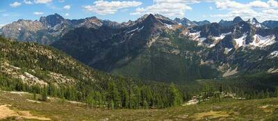
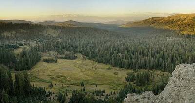
Images in order: Pacific Crest Trail by Jonathon Miske via Flickr; PCT Sign by Daveynin via Flickr; PCT Cutthroat Pass by Miguel Vieira via Flickr; PCT Tom's Valley by Miguel Vieira via Flickr
