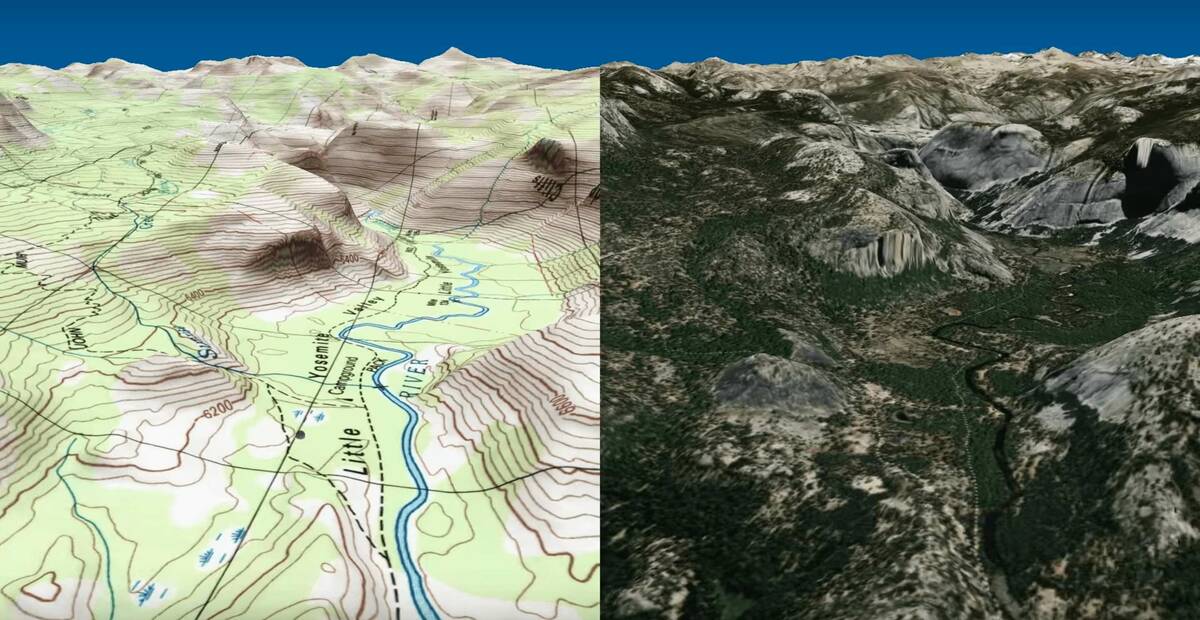
Backpackers.com — Trail junkies, trip planners, and the overly detailed — this one's for you. It came to our attention recently that a YouTube channel, Eastridge Technology (a.k.a. Route 3D), has created videos that depict topographic and aerial footage of two major trails — the John Muir Trail in California and the North Rim to South Rim (Rim to Rim) Trail in the Grand Canyon.
Topographic Aerial Trail Video of the John Muir Trail
The John Muir Trail runs 210 miles through the Sierra Nevada mountain range of California. The northern and southern terminuses are Happy Isles in Yosemite Valley and the summit of Mount Whitney. It's a beloved trail due to the high peaks one has to cross, the stunning and sometimes desolate wilderness, and the legend of John Muir. The trail officially began construction in 1918 and was pioneered by various members of the Sierra Club, where John Muir served as the first president. Muir died the same year the construction of the trail began, and so was named in his honor.
See the 210 miles traveled in both topographic mapping and through aerial 3D footage below.
The small dot on each map represents the actual trail one would travel.
Topographic Aerial Trail Video of the Grand Canyon Rim to Rim
Much shorter than the JMT, the Rim to Rim hike in the Grand Canyon is 24 miles from one edge of the world's most famous chasm to the other. It can be done as a strenuous day hike, a two day journey with a stay at Phantom Ranch, or a 3-4 day backpacking trip for those that want to take their time. Any variation of that works, and you can start at the North or South Rim. However, the North Rim is 1,000 feet higher than the South Rim, so most people start there — climbing straight up for an extra 1,000 feet is, perhaps, less than ideal for some.
For those doing the traditional route (North to South), you'll leave from the North Kaibab Trail, descending 14.3 miles and 6,000 feet to reach the bottom of the canyon. Then you'll connect with Bright Angel Trail and climb up 4,500 feet in 9.6 miles, cresting on the South Rim. This is the route shown below.
The small dot on each map represents the actual trail one would travel.
Route 3D
How cool are these videos? They're made possible with a technology called Route 3D, which was developed by Eastridge Technology.
“Route 3D plays back routes on a three dimensional moving map, showing each turn and change in elevation. Use it to preview or review your hiking, biking, climbing, or car trips. Switch between high detail topographic maps and aerial photography.enables anyone — yes, you — to take a trail and create a topographic video map.”
The technology is available for free for browsers, Android, and Apple iOS mobile systems. You'll need a Java plug-in to get the browser version working. With this tech you can create your own 3D trail mapping, or you can view more of the pre-made routes.
Enjoy!
