
Explore any wilderness at the touch of your fingertips with the onX Backcountry app. Designed for everyone from summer trailblazers to winter powder seekers, the multifaceted onX Backcountry app features multiple map layers, expert-curated guidebook content, and GPS navigation tools that'll give you a bird's eye view wherever adventure takes you.
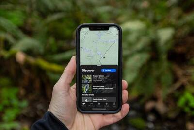
Discover new trails and record your trips with onX Backcountry.
Whereas the likes of Google and Apple can help you find your way from point A to point B in the city, onX knows how to navigate what lies beyond the pavement. Many of us have by now used GPS devices and mapping apps to help us find our way in the wilderness, but onX Backcountry was purpose-built for hikers, backpackers, snowshoers, and everyone else intent on wandering backcountry trails.
Create and navigate your own path across the countryside.
onX Backcountry: The Map App for Explorers
onX Backcountry is a versatile app that works well for any season and any type of terrain. Year-round outdoor adventure enthusiasts will appreciate the duality of trail mode and snow mode. In trail mode, you'll have instant access to all the recreation points, hiking trails, and backpacking routes that exist in any given area.

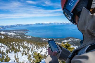
See what the surrounding terrain looks like at any time of year.
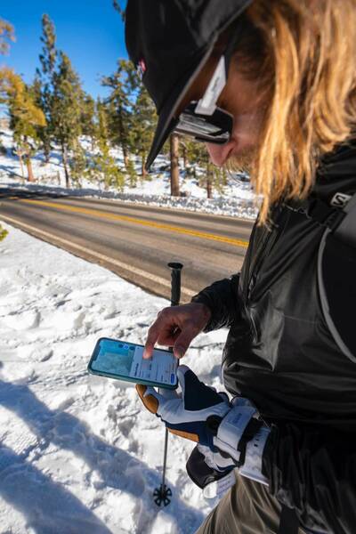
With a simple tap of the screen, you can activate snow mode for seasonally appropriate maps and informational overviews of nearby winter recreation areas. Nearby adventure opportunities will be curated for snowbound expeditions, and you'll be given vital winter recreation data such as slope angles and local avalanche reports. This data is indispensable for cross-country skiers and snowshoers.
Plan your route in any season across any terrain.
What's more, all of this is available in multiple adjustable and selectable layers. No matter the season, onX Backcountry allows you to filter through all of the data you need to plan and head out on your next trip.
Trails and adventures can be viewed via an assortment of map layers including satellite imagery, 24k topographic maps, a hybrid of the two, or 3D imaging. Additionally, you'll be able to access land management layers such as BLM and Wilderness Study Areas so that you can see those important land boundaries at a glance.
Easy to Use GPS Navigation and Adventure Guides
Among the list of useful features of the onX Backcountry app is the ability to download maps for offline use. Gone are the days when hikers needed to carry NFS brochures and booklets containing pages of wilderness maps—now, you can take all of the mapping data you'll ever need on your smartphone, tablet, or laptop (just don't forget to bring a spare battery charger for longer trips!)
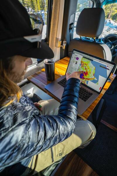
Download maps to access them offline when you're out of service.
Offline maps allow trail-goers to access their location data at a moment's notice with near-perfect accuracy. This allows you to find your way safely using GPS at all times even when there is no cellular service to be found.
Dropping digital breadcrumbs.
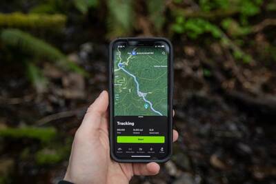
The app is also loaded with helpful tools such as a tracker and customizable waypoints so that you can record your adventure data to share, revisit, or recount in the months and years ahead. It's even possible to share your custom waypoints when you're completely offline and off-the-grid via the onX Backcountry app's Somewear satellite communication integration—and that's something your loved ones will surely appreciate.
onX Backcountry, Hunt, and Offroad Apps
onX Backcountry is an invaluable tool for adventurers of all ilks. With it, the world is yours to explore. There are over 650,000 miles of trails and 1,500 curated adventures on the app to discover, with even more on the way.

onX Backcountry enables you to design your own outdoor adventure.
Similarly, onX has developed the onX Hunt and onX Offroad apps to provide detailed adventure maps and GPS navigation for other outdoor enthusiast communities. Each of these apps is like having an all-knowing outdoor guide in your pocket with hand-crafted route recommendations and relevant resources for your excursions.
This article is sponsored by onX.
Backpackers.com Affiliate Policy: This guide contains affiliate links, which help fund our website. When you click on the links to purchase the gear we get a commission, and this goes a long way to creating guides, gear reviews, and other excellent content.
thanx 4 gr8 info!
I currently, use the onX hunting app. When my subscription expires, I will check out the onX backcountry!
They’re both great to have depending upon how you explore the outdoors! If you frequent hiking and backpacking trails, onX Backcountry is definitely worth a try.
What is the difference between OnX and AllTrails?
That’s a great question! They’re both GPS apps with excellent trail info. AllTrails has their excellent community-built resource of information, while onX has developed their own trail maps and adventure routes for you to explore. Plus, onX also has loads of information for overlanders and hunters as well, and onX works with REI’s Hiking Project trail database.
[…] onX Backcountry helps outdoor explorers find great adventures, navigate in remote places, and get home safely. Tens of thousands of guidebook and expert-curated adventures and 650,000 miles of trails provide inspiration, while the App’s GPS tools are tailored to the needs of hikers, backpackers, trail runners, and backcountry skiers of all skill levels. See our full highlight of onX Backcountry. […]
Which has a larger database of trails? AllTrails or Backcountry? Do either allow you to design a trail plan/route that you can download to your mobile device and use offline while out and about?